Trail Walking La Celle-les-Bordes - _Animaux de la ferme et faune sauvage - Photo

_Animaux de la ferme et faune sauvage

Randonnées du Parc naturel régional de la Haute Vallée de Chevreuse GUIDE+

© OpenStreetMap contributors
Length
Length
12.7 km
Max alt
Max alt
183 m
Uphill gradient
Uphill gradient
63 m
Km-Effort
Km-Effort  
13.5 km
Min alt
Min alt
169 m
Downhill gradient
Downhill gradient
62 m
Boucle
Boucle
Yes
Creation date :
2017-05-22 00:00:00.0
Updated on :
2017-05-22 00:00:00.0

(1 Reviews)

Walking
Walking
3h00
Difficulty : Medium

Scan this QR Code to open this trail in the SityTrail application

FREE GPS app for hiking

Logo SityTrail SityTrail

IGN / Geographical institutes

Download SityTrail from the App Store Download SityTrail from Google Play

Logo SityTrail SityTrail World

The world is yours!

Download SityTrail from the App Store Download SityTrail from Google Play Download SityTrail on Huawei AppGallery

About

Trail Walking of 12.7 km to be discovered at Ile-de-France, Yvelines, La Celle-les-Bordes. This trail is proposed by Parc naturel régional de la Haute Vallée de Chevreuse.

Description

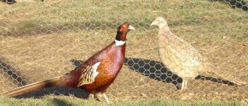
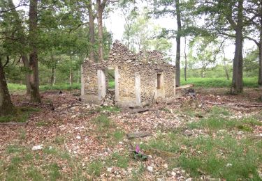
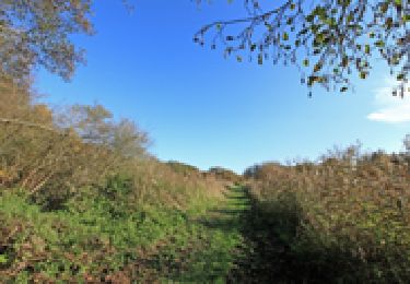
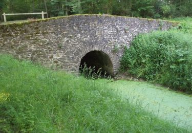
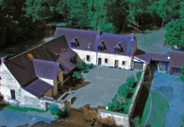
De la récente ferme des Trois ponts à l’ancestrale ferme de Saint-Benoît, cette balade nous amène à côtoyer ovins, bovins, faisans et autres volatiles. Un itinéraire dépaysant alliant paysages forestiers et champêtres.

Elevation profile

Photos

Points of interest

Point of interest Auffargis - Traversée dangereuse - Photo
Parc naturel régional de la Haute Vallée de Chevreuse
Point of interest Auffargis - Ruches - Photo
Parc naturel régional de la Haute Vallée de Chevreuse
AUFFARGIS 
Point of interest Auffargis - Ruches - Photo
Parc naturel régional de la Haute Vallée de Chevreuse
AUFFARGIS 
Point of interest Auffargis - Faisanderie - Photo
Parc naturel régional de la Haute Vallée de Chevreuse
AUFFARGIS 
Point of interest Auffargis - Ferme Saint-Benoît - Photo
Parc naturel régional de la Haute Vallée de Chevreuse

Positioning

Country:
France
Region :
Ile-de-France
Department/Province :
Yvelines
Municipality :
La Celle-les-Bordes
Location:
Unknown
Start:(UTM)
420800 ; 5389699 (31U) N.

Comments

Please log in to post a review or rate the element


Trails nearby

Trail Walking Cernay-la-Ville - _Senlisse dans un écrin de verdure - Photo
Walking
GUIDE+

Walking

Easy
(12)
Cernay-la-Ville, Ile-de-France, Yvelines, France
4.5 km | 5.7 km-effort
1h 30min
Yes
Trail Walking La Celle-les-Bordes - _Sensations originelles - Photo
Walking
GUIDE+

Walking

Medium
(8)
La Celle-les-Bordes, Ile-de-France, Yvelines, France
13.6 km | 16 km-effort
3h 30min
Yes
Trail Walking Clairefontaine-en-Yvelines - _Aux sources de la Rabette - Photo
Walking
GUIDE+

Walking

Easy
(15)
Clairefontaine-en-Yvelines, Ile-de-France, Yvelines, France
7.2 km | 8.3 km-effort
1h 51min
Yes
Trail Walking Vieille-Église-en-Yvelines - _Les rigoles royales, reines de la plaine - Photo
Walking
GUIDE+

Walking

Medium
(5)
Vieille-Église-en-Yvelines, Ile-de-France, Yvelines, France
10 km | 11 km-effort
2h 30min
Yes
Trail Walking Cernay-la-Ville - _Moulins des vaux de Cernay - Photo
Walking
GUIDE+

Walking

Easy
(9)
Cernay-la-Ville, Ile-de-France, Yvelines, France
6.3 km | 7.8 km-effort
2h 0min
Yes
Trail Walking Senlisse - _Sentier découverte des maréchaux - Photo
Walking
GUIDE+

Walking

Easy
(4)
Senlisse, Ile-de-France, Yvelines, France
4.3 km | 5.4 km-effort
1h 12min
Yes
Trail Walking Cernay-la-Ville - _Les Vaux de Cernay - Photo
Walking
GUIDE+

Walking

Medium
(3)
Cernay-la-Ville, Ile-de-France, Yvelines, France
8.4 km | 10.4 km-effort
2h 15min
Yes
Trail Walking La Celle-les-Bordes - _Entre allées royales et pâtures - Photo
Walking
GUIDE+

Walking

Easy
(2)
La Celle-les-Bordes, Ile-de-France, Yvelines, France
7.7 km | 9.5 km-effort
2h 0min
Yes
Trail Walking Le Perray-en-Yvelines - Les Vaux de Cernay - Photo
Walking
tracegps

Walking

Difficult
(4)
Le Perray-en-Yvelines, Ile-de-France, Yvelines, France
23 km | 26 km-effort
4h 45min
Yes


Close
My subscriptions